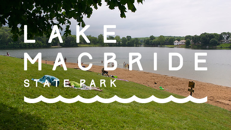
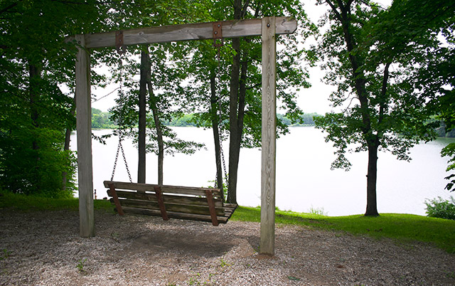
Lake Macbride is the star at Iowa’s largest State Park. Two wooded valleys created Lake Macbride’s unique shape when Mill and Jordon creeks were dammed in the 1930’s. The park boundaries are never far from the shoreline. That creates a recreation space with beautiful views and unfettered access to the lake from any location in the park. The lake has every possible amenity for water sports in Iowa; however, there is a 10 horsepower motor limit on boats and speed restrictions.
It’s easy to get on the water with seven boat ramps on Lake Macbride and one additional ramp on Coralville Lake. The ramps are in excellent condition and each have a floating dock nearby. Water levels at the Macbride boat ramps remain relatively constant due to the lake’s spillway.
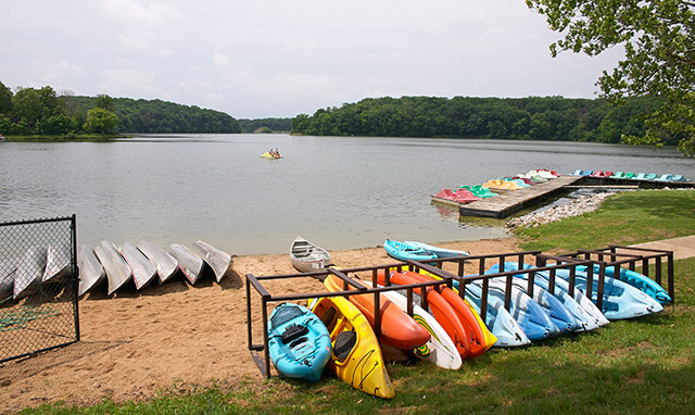
The Lake has a boat rental facility at the marina near the beach. They offer pontoon boats, fishing boats, canoes, kayaks, stand up paddleboards and paddle boats for rent. You can try your hand at a sailboat if you take lessons through the University of Iowa Sailing Club. Lake Macbride also has pontoon dock spaces available for rent, as well as dry-storage spots for boats.
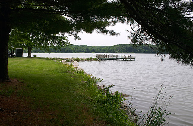
You don’t need a boat to take advantage of the piers, docks and other shoreline fishing locations around the lake. The DNR says that walleyes, channel catfish, crappies, muskie, and Kentucky spotted bass can be caught at the lake.
The beach at Lake Macbride State Park is large and very popular. A mowed grassy hillside with a few shade trees overlooks the clean sandy beach. The parking lot is vast and can accommodate a high volume of beach goers at peak use times in the summer. A nearby concession stand offers refreshment and snacks.
Other amenities at the park include: two reservable lodges, two campgrounds, 16.26 miles of trails, picnic shelters and restroom facilities.
Campgrounds
There are plenty of camping options at the parks two campgrounds. A modern campground is located on the northwest side of the lake near the dam and a primitive campground is located on the south arm of the lake. The town of Solon is a convenient distance from both campsites if you need to stock up on supplies.
The modern campground is nestled in a dense stand of trees and has 38 electrical sites with 10 having full hookups. The back-in sites are level crushed stone pads and most are well shaded. This campground has a modern restroom and shower facility as well as a dump station for RV’s. A nice perk to camping here are the scenic views of the dam and spillway from the nearby trails. To get there look for a small trail at the end of the campground’s south loop. That will lead you to the Beach to Dam trail. One unusual aspect about this campground is that the playground is not technically in the campground. Kids seem to enjoy the downhill bike ride to the playground, but watch for cars on the road.
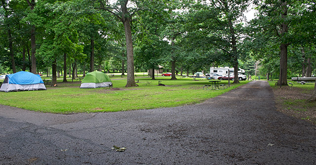
The large primitive campground has 60 non-electric sites. There is a non-flush restroom facility in the campground and another restroom with flush toilets, running water but no showers on the south side of the campground. Most of the sites here are grass with some sites showing a few worn patches of dirt. The area as a whole slopes at a gentle grade towards the lake but the sites are fairly level. The campground has an open feeling with many strategically placed large trees to provide shade for campers. Sites closer to the lake have less shade. There is a children’s playground near the south entrance. Fishing is a big activity at the primitive campground. As you enter the campground you will find a boat ramp, parking lot, fish cleaning station, restroom and fishing jetties.
Printable Trail Map
Trail Map Bandana
Trails
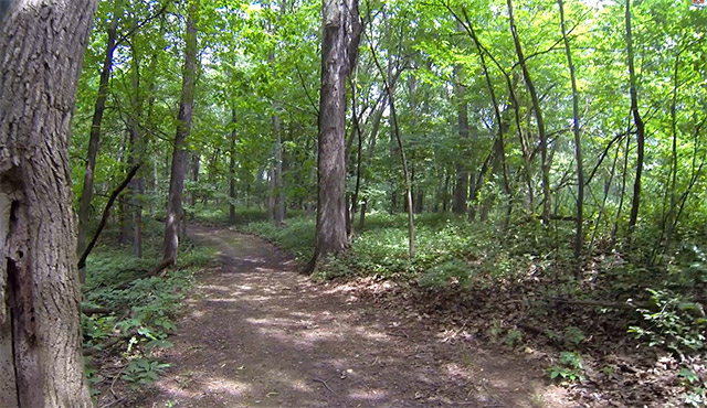
The 16.26 mile trail system at Lake Macbride State Park is distributed around the perimeter of the lake. Many of the trails are labeled multi-use which means hiking, snowmobiling, cross country skiing and one trail allows biking. With the exception of the interpretive hike all the trails offer some type of lake view. It’s difficult to find a combination of trails to create a loop hike, but with some road trekking you can find a couple routes.
– Beach to Dam Trail
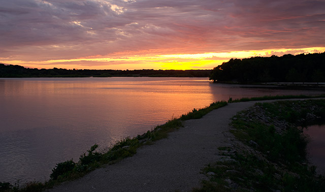
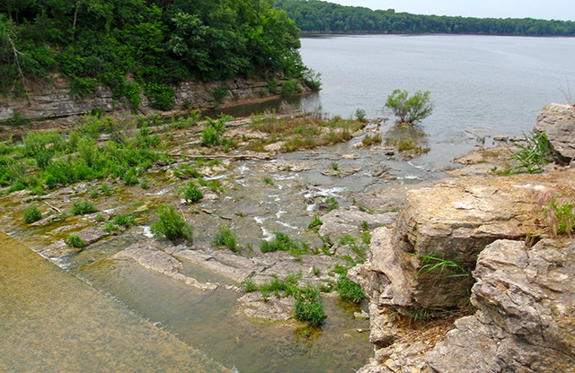
This is a popular 1.45 mile hike on a well maintained multi-use trail. The trailheads are at the beach near the boat rental building and another at the boat ramp west of the beach. Additionally, you can access the route from tributary trails that come down from the playground and at the end of the south loop of the modern campground. Views at the dam and spillway are some of the best in the park and both Coralville Lake and Lake Macbride can be seen here. Bikes are not allowed but this would be an excellent cross country ski path in the winter. Hike to the dam for spectacular sunrises or sunsets.
– Northern Snow Mobile Trail
Now and then this 1.5 mile multi-use path offers a glimpse of Coralville Lake to the west. The trail is a little more rugged and has many ups and downs to keep your blood pumping. Bikes are not allowed, but there are plenty of signs that this is a popular snowmobile route.
– Interpretive Trail
The interpretive trail is a short .43 mile educational loop. There are informational plaques noting flora and fauna along the way. As of this writing; the signage, sitting station and the path are in need of some maintenance. Don’t let that detour you from checking out this quiet and scenic hike.
– North Shore Trail
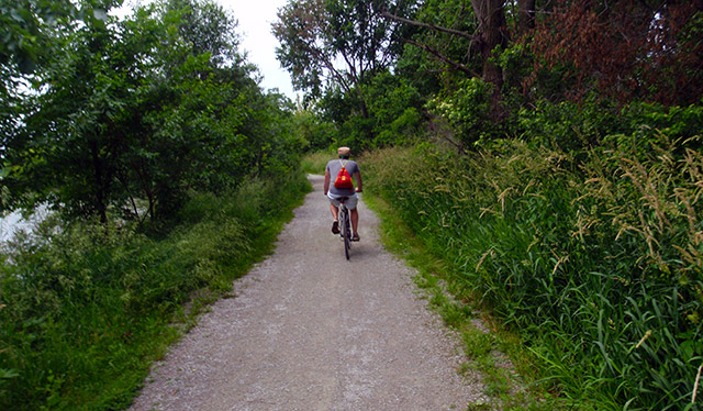
Perhaps the lake’s premier trail, this 4.9 mile crushed stone multi-use trail is a favorite of bike riders. The route traverses the north shoreline of Lake Macbride between the park’s north entrance and the city of Solon. In Solon you can quench your thirst at one of the town’s watering holes or refuel at a restaurant for the ride back. You rarely lose sight of the lake on this ride and there are many places to stop and take in the views. Take note of the interpretive plaques along the trail that provide information about plants and animals in the area.
– Old Entrance Trail
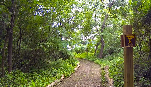
This is a short .25 mile multi-use trail along the shoreline. Use this route to find a fishing location. There is a nice portage facility near the east trailhead. It appears to be a way to portage the neck of the peninsula to the boat ramp.
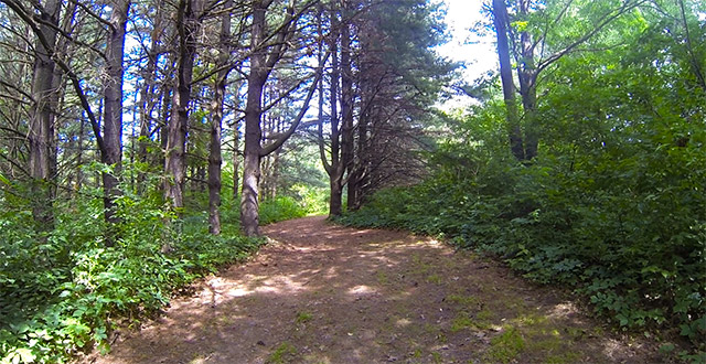
– White Pine Trail
White Pine Trail is a single use 1.4 mile hiking trail through the woods. It’s wide and well maintained with a gentle grade. Views of Lake Macbride can be seen from the north end of this trail. The route would make a beautiful stroll on a fall day.
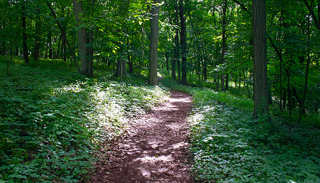
– Osprey Trail
You will find variety on this multi-use 1.4 mile lollipop loop hike. I encountered stands of pine trees, prairie savannah and shoreline wetlands. The trail is a level, wide and well maintained. The diverse scenery provides birders with a unique location to spot an abundant assortment of birds.
– South Shore Trail
Wide open views and shoreline fishing are the highlights on the .9 mile multi-use South Shore Trail. Take in the lake views as you walk through prairie grasses from the campground boat ramp to Mehaffey Bridge.
– Brock’s Bridge Trail
This is a wooded .3 mile trail along the shoreline. It’s used to hike into multiple fishing locations on the southeast side of the lake.
– South Snowmobile Trail
Follow a 1.33 mile multi-use tree lined route along the lake shore. This trail is wide but seemed less maintained. The trail name is probably an indication of the best use of the path.
– Angler Point Trail & Field Campus Trail
Combine these two routes to create a continuous 2.4 mile hike along the south ridge lines of the lake. The trails are designated single use hiking and provide a long quiet walk in a dense canopy of trees. The varied elevation, occasional water views and remote feeling made this my favorite trek at Lake Macbride State Park. The trail terminates at the spillway, however, I witness people crossing over to the Beach to Dam Trail in low water flow conditions.
Final Impressions
Lake Macbride State Park is an accessible park due to its location near the intersection of I-80 and I-380. Its popularity is also bolstered by the nearby cities of Cedar Rapids and Iowa City. As one of Iowa’s 10 most visited parks, the campgrounds, marina and beach can be busy social spots in the peak season. If you want to get away from the crowds, try renting a boat and get on the water. You will also see fewer people on one of the single use trails. I recommend a hike on the Field Campus Trail for its backwoods ambiance.
[…] a perfect Iowa spring day my husband and I took our toddler son to walk near Lake McBride. We followed just a bit behind, trying to allow him some space to explore. Every few steps he […]
When when i main area going to open to the public?
I would contact the ranger at 319-624-2200.
Are you doing pontoon, boat, paddleboat, canoe and kyak rentals and if so what are the hours? Can you call ahead to be able to get one for sure or is it first come first serve?
Iowa Parklands is not affiliated with the Iowa DNR. The boat rental number is (319) 624-2315 Enjoy! 🙂