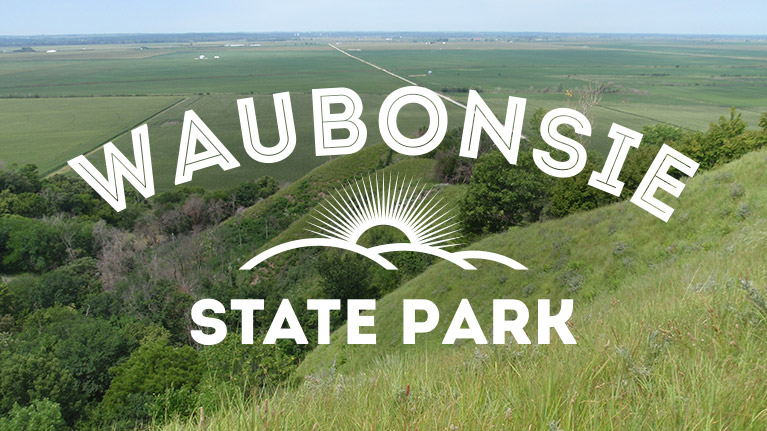
Waubonsie State Park is located in the southwestern corner of the state at the southern tip of Iowa’s Loess Hills. The park’s remote location helps keep crowds and trash down in the park. I was there the weekend of the rodeo in nearby Sidney and the campground was about ¾ full. Getting to Waubonsie State Park is surprisingly simple via HWY 29 south to HWY 2 east. HWY 29 is a dream to travel with a camper in tow. The road is dead flat with a spectacular view of the Loess Hills to the east.
Although modern land practices of the past have allowed trees to encroach on the hills in the park, there are a couple trails that traverse prairie covered ridgelines. You can get a sense for what William Clark of the Lewis and Clark expedition described as “bald-pated hills”.
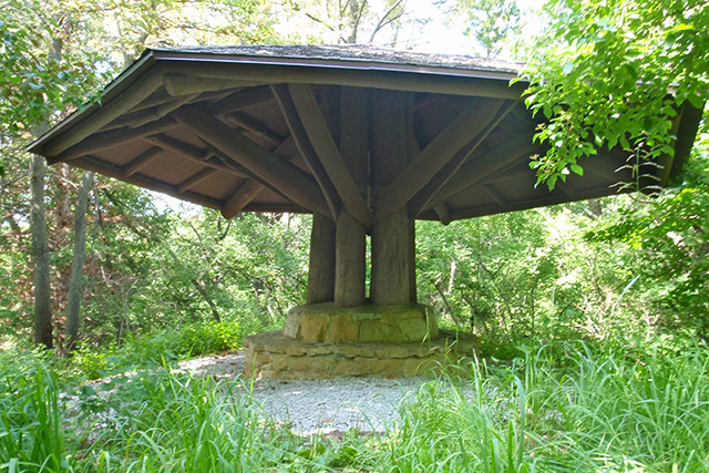
Waubonsie State Park is one of Iowa’s older state parks and I always enjoy locating the old C.C.C. (Civilian Conservation Corps) structures that were built in the 1930’s and 1940’s. Waubonsie State Park has two of the most unique C.C.C. structures I have ever encountered. They are mushroom shaped shelters that appear to have been restored recently.
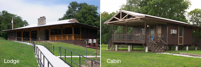
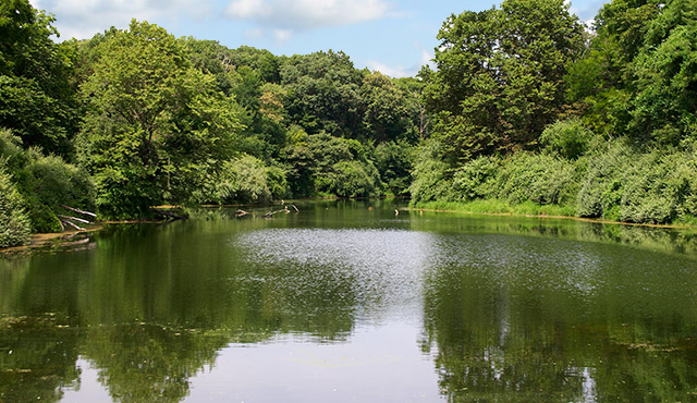
In 2005 the Iowa DNR (Department of Natural Resources) acquired the 646-acre Wa-Shawtee Girl Scout camp from a private land owner. The purchase doubled the size of Waubonsie State Park and today, many of the assets on that land have been developed for use by the public. Newer amenities include the former Wa-Shawtee camp staff living quarters that have been remodeled into rental modern cabins. A day-use lodge is available for group rentals year-round and a seven-acre fishing pond called Lake Virginia offers parking and a boat ramp. The DNR says that more cabins, a remodeled Nature Center, new trails, picnicking areas, and improved shoreline fishing opportunities will be available in the future.
Campground
Waubonsie State Park has two campgrounds. The main campground is south of HWY 2 and the equestrian campground is on the north side of HYW 2. Both are clean and well maintained. Half of all the sites can be reserved online. Use caution during the daytime hours on the weekdays. There is a landfill nearby and large trucks come up fast when turning into the park off of HWY 2.
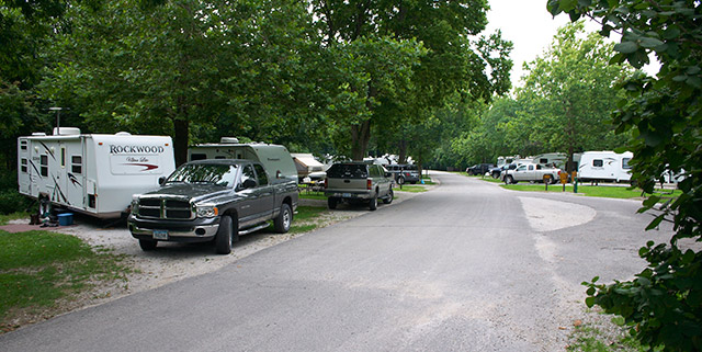
The main campground is tidy and has a respectable 40 sites with 24 having electrical. The campground road makes a big loop that allows large trailers to easily maneuver when searching for one of the back-in camp sites The majority of sites are shady with level to slightly sloped gravel camp pads. The modern shower house and a dump station are centrally located in the campground and available for people staying in both campgrounds and the cabins. The campground is sited up on a ridge which provides excellent television and cell phone reception. Trailheads to several of the parks single-use hiking trails are close to the campground.
The equestrian campground is spacious and can easily accommodate large horse trailers with tow vehicles. This facility has 32 non electric sites, corrals, hitching posts, water spigots, and two non-modern rest rooms. The camp pads are grass and vary from slightly sloped to level. There are some nice shade trees, but many of the sites are fairy sunny. 5.43 miles of multi-use trails surround the equestrian campground and are easily accessed via multiple trailheads.
Printable Trail Map
Trail Map Bandana
Trails
Waubonsie State Park has a total of 11 miles of trails. 5.57 miles are single use hiking trails and the other 5.43 miles are single-use equestrian trails. The two trail systems are completely separate with the equestrian trails on the north side of the park and the hiking trails on the south side.
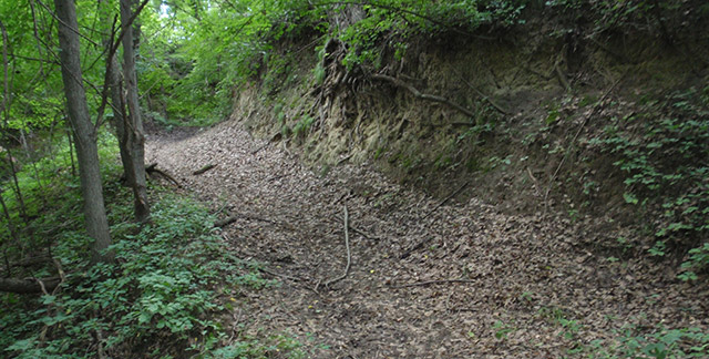
The equestrian trails wind through the timbered terrain of the Loess Hills. You will experience a good mix of challenging ups and downs as well as peaceful flat rides in the woods and along creeks. Many of the trails are steep and the loess soil can easily erode these sections after significant rains.
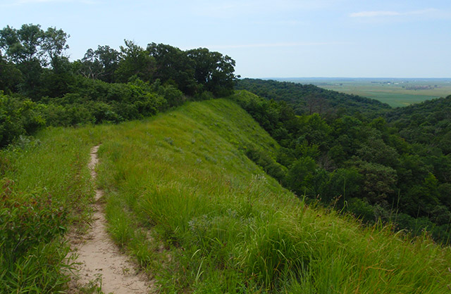
Hiking in Waubonsie State Park will give you a sense for what native people and early explorers once saw here. Several of the ridge trail hikes retain their prairie grasses and panoramic views. The remaining trails wander through densely wooded areas of the park. It’s possible to access all the hiking trails and configure a loop hike to suit your needs. The park’s trails are in good shape, but trail markers and signage are not. Be sure to bring a map to find your way.
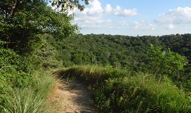
My favorite trails in Waubonsie State Park are the 1.5 mile Sunset Ridge Trail and the .5 mile Ridge Trail. If hiking during peak time for ticks, you will need to check yourself after walking through the tall prairie grass on these trails.
Traveling clockwise, Sunset Ridge Trail offers a lot of variety. The first 2?3 rds is moderate terrain on a well maintained path. Your payoff on this trek will be the spectacular views to the west. It would be a peaceful place to watch the sunset; however you will need a flashlight for the trip back. The last 1?3 rd of the trail takes you down a ravine and back up again. Be sure to look for an old concrete cellar in this southern section.
The Ridge Trail is a scenic in-and-out hike along a loess bluff ridge line. The dirt path cuts a route through prairie grasses and flowers. The entire trail presents a wide open view west over a wooded valley and the Missouri River flood plain. The walk back is surprisingly different and I took note of many plants, animals and sounds I hadn’t noticed on the trip out.
The remaining trails are hikes in wooded areas of the park. One of my favorites is the Bridge Trail. It runs along another mostly level ridge line and does not have as much traffic as other trails.
Closer to the campground you will find the CCC Mushroom Shelter Trail, Picnic Area Trail, the Ed Mincer Interpretive Trail and Valley Trail. The CCC Mushroom Shelter Trail has a fairly steep grade down into the picnic valley area. Other than that, all these are manageable to hike. Keep your map handy when hiking the Valley Trail. It can be confusing to stay on course because of the poor signage. The Ed Mincer Interpretive Trail was a pleasant hike but I didn’t see any educational signage or interpretive information on the trail.
Final Impressions
Waubonsie State Park is a gem of a state park. The well-tended campground, unique cabins, and trail system are the highlights for me. The trail signage issues are most likely due to funding and not neglect. It’s obvious that the park is well cared for by the staff. I’m looking forward to going back to hike the new trails that will be developed in the future. You should absolutely include Waubonsie State Park on any tour of the Loess Hills.
Mati,
My dad, Louis E. Kuester, was with the CCC camp near Bloomfield that completed the work at Lake Wapello and then we lived in Sidney, while that camp built the structures at Waubonsie. I have many memories of picnicking at the park. The views of the Missouri and of those shelters is with me yet (and I am 90)
That’s fantastic Louis! I would love to go back in time and help build some of the park structures. Those Mushroom shelters are so unique.
We did see the old cellar on the Sunset ridge trail, do you know the history behind it? Like when and why it was built? Thank you for your time!